
Ellis
County, Kansas
Archives

|
Ellis
County, Kansas |
|
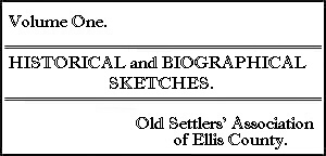 |
This historical booklet, entitled Historical and Biographical Sketches, was printed around 1900 and was intended to be the first volume of a history of Ellis County. The second volume was to be printed in 1901 but was apparently never printed. This volume contains the history of Fort Hays, Rome, and Hays City. Biographical sketches of Mrs. A. M. Wilson, John Hall, P. W. Smith, Peter Gosser, T. K. Hamilton, Frank C. Montgomery, John Schlyer, Margery Harlan Reeder, and D. C. Nellis. |
| Souvenir of Hays City and
Ellis County 1908 |
Coming... |
| It pays to live in Hays,
Because Souvenir Booklet, 1920 |
Coming... |
| Hays City (Fort Hays)
Kansas, Boosters' Club of Hays City aprox 1915 |
Coming... |
| Historic Hays, Hays Lions
Club 1938 |
Coming... |
| The Story of Old Fort
Hays and Early-Day Reminiscences by Eye Witnesses aprox 1931 |
Coming... |
| Golden Jubilee of the
German-Russian Settlements of Ellis and Rush Counties, Kansas August 31, September 1 and 2, 1926 |
KSGenWeb Archives |
| 1866 Map | Ellis County section taken from Colton's Kansas, copyright 1866. G. W. and C. B. Colton & Co. |
| 1870 Map | Ellis County section taken from S. C. Griggs & Co. Sectional Map of Kansas dated 1870. |
| 1876 Map | Ellis County section taken from Rand, McNally & Co. Postal Map of Kansas dated 1876. |
| 1879 Map | Ellis County section taken from State of Kansas map by Bien, Julius (photo. lith. & print.), dated 1879. |
| 1880 Map | Ellis County section taken from Cram's Rail Road & Township Map of Kansas, copyright 1878 with content of 1880. |
| 1883 Map | Ellis County section taken from Cram's Rail Road & Township Map of Kansas, with content of 1883. |
| 1885 Map | Ellis County section taken from Gray's New Map of Kansas, Frank A. Gray. |
| 1887 Map | Ellis County section taken from A. A. Grant's 1887 Railroad and County Map of Kansas |
| 1887 Map | Ellis County section taken from Page's Map of Kansas 1887 |
| 1888 Map | Ellis County section taken from Rand, McNally & Co.'s New Business Atlas Map of Kansas, 1888 |
| 1889 Map | Ellis County section taken from Map of Kansas from Milton R. Brown, 1889 |
| 1889 Map | Ellis County section taken from a map of Kansas in Johnson's Cyclopaedia, 1889 |
| 1897 Map | Ellis County section taken from a map of Kansas by the Century Company, 1897. |
 |
 |